Drone LiDAR Service
Learn more
Utility Service & Support
Learn more
Confined Space Inspection
Learn moreLatest News & Updates from AeroVision
-

AeroVision Global Assessed "Awardable" for Depa...
Tampa, FL – April 2, 2026 – AeroVision Global, a leading provider of unmanned aerial system (UAS) solutions and North America's authorized distributor of the ANAVIA HT-100 and HT-750 UAS,...
AeroVision Global Assessed "Awardable" for Depa...
Tampa, FL – April 2, 2026 – AeroVision Global, a leading provider of unmanned aerial system (UAS) solutions and North America's authorized distributor of the ANAVIA HT-100 and HT-750 UAS,...
-

How Sonar Is Changing What We Can See Below the...
If you manage a large lake, reservoir, or waterway, you already know the challenge. What is happening beneath the surface is often the most important question and the hardest one...
How Sonar Is Changing What We Can See Below the...
If you manage a large lake, reservoir, or waterway, you already know the challenge. What is happening beneath the surface is often the most important question and the hardest one...
-

AeroVision Global to Showcase Advanced Unmanned...
March 9, 2026, Nashville, TN: AeroVision Global to exhibit at PowerXchange 2026, bringing advanced UAS solutions purpose-built for electric cooperative infrastructure, says President and CEO Trevor Bergmann. "Electric cooperatives are...
AeroVision Global to Showcase Advanced Unmanned...
March 9, 2026, Nashville, TN: AeroVision Global to exhibit at PowerXchange 2026, bringing advanced UAS solutions purpose-built for electric cooperative infrastructure, says President and CEO Trevor Bergmann. "Electric cooperatives are...
-

How AeroVision Is Redefining Drone Utility Insp...
The energy sector is undergoing a transformation. As grid operators take on growing demands for reliability, the tools they use to monitor and maintain infrastructure must keep pace. Unmanned aerial...
How AeroVision Is Redefining Drone Utility Insp...
The energy sector is undergoing a transformation. As grid operators take on growing demands for reliability, the tools they use to monitor and maintain infrastructure must keep pace. Unmanned aerial...


ANAVIA HT-100
The ANAVIA HT-100 is a long-range, heavy-lift unmanned aerial vehicle (UAV) designed for autonomous flight operations across multiple applications. Deploy the most advanced unmanned performance helicopter to use in your operations today. AeroVision is the sole distributor and in-country support partner of the ANAVIA HT-100 in North America.

Disaster & Emergency Response
Drones create a detailed, time-stamped historical record of the scene's evolving state, capturing vital information throughout the operational period. This data supports next-day planning by offering insights into previous actions and informing future strategies. It also serves as a key resource for after-action reports, enabling thorough analysis of response efforts and identifying areas for improvement.

Aerial & Terrestrial LiDAR
LiDAR offers exceptional accuracy, capable of detecting small changes in elevation and vegetation density, making it ideal for precision mapping. By eliminating the need for manual surveys in hazardous areas, drone-based LiDAR scans enhance worker safety while maintaining data quality.
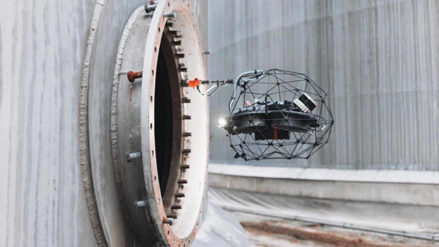
Remote Confined Space Inspections
While a confined space drone may not be suitable to replace all aspects of the confined space environment, it can help provide preliminary visual inspections more quickly, at a lower cost, and with significantly lower risk.
Learn About The Industries We Serve

Energy & Utilities
Learn more
Oil & Gas
Learn more
Professional Sports Infrastructure
Learn more
First Responders & Public Safety
Learn more
Construction & Infrastructure
Learn more
Underwater Survey
Learn moreFeatured Case Studies

Terrestrial LiDAR Technology: Helping Launch a New Era in Golf
- Terrestrial LiDAR
- Professional Sports Infrastructure
- Surveying & Mapping

Aerial LiDAR: Delivering Better Data, Faster for a Major Highway Expansion in Nova Scotia
- Drone-based LiDAR
- Construction & Infrastructure
- Detailed Topographic Data

How LiDAR Drone Services are Revolutionizing Industrial Inspections
- Confined Space Inspections
- Visual & LiDAR Inspections
- Flyability Elios 3